Streamline your planning with AfriGIS GISlike
- your customers are
- you need to deliver services
AfriGIS GISlike enables our clients across various government and private industries to adjust their trade areas, sales strategies and decision making processes.
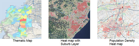
Information is visually displayed on different maps, such as heat maps, immediately indicating areas to be reviewed.
AfriGIS GISlike is an online mapping and analysis application that enables you to streamline your planning and operations by mapping your own data, together with extensive AfriGIS and Census datasets - therefore you can view and analyse your customer data on a map and then adjust or modify your trade areas or maintenance and sales strategies in context of Census and other AfriGIS datasets.

Benefits
- Free online demographic mapping
- Market, consumer and risk profiling
- Market research
- Risk analysis/management
- Trend analysis
- Gap analysis to determine potential business areas
- Municipal asset management
- Powerful simplicity
Try it now:
https://www.afrigis.co.za/solutions/products/evaluate/gislike/
- Turning strategy into action: How AfriGIS supports SA’s geospatial information management strategy?27 Oct 09:56
- Geospatial in Africa: The highs, the lows, and what’s ahead in 202508 Oct 12:13
- AfriGIS preserving South Africa’s heritage02 Oct 16:08
- Restoring trust in municipalities through GIS-enabled asset management systems29 Sep 13:56
- How geospatial insights can transform service delivery planning and analysis in South Africa03 Sep 10:09