Data provides powerful location insights

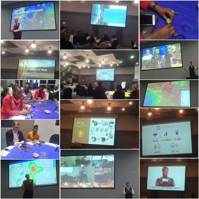
The second quarter AfriGIS Data and Spatial Workshop took place in Midrand on 12 June 2018 where the company continued to share more insights on utilising big data, from how you can apply spatial strategies to incorporating it into our own data.
The workshop kicked off with a presentation from Lourens Snyman, AfriGIS GIS Analyst, who demonstrated how the combination of different sources of data can provide a practical application to use as a part of your business operations. He gave an overview and demonstration of the processes of big data and the actual steps that combine different datasets and geographic information systems (GIS) to answer questions with location insights.
Christopher Ueckermann, AfriGIS Data Manager, then presented the data processes and updates of this release, as well as highlighting changes and additions made to the AfriGIS Datasets such as National Address Database (NAD), Street Centrelines, Sectional Schemes and Gated Communities. He also reported on the progress made in gathering the available data and combining it with the different data sources to produce results. “It is all about data enhancement and taking data to the next level. Yes, the data is good but what can we do to make it more usable to our clients?” The answer lies in the quality of data. Quality data provides accurate answers and the AfriGIS Data team continues to spend more time in verifying information to provide the most up to date and accurate data.
Marna Roos, representing AfriGIS on various Data Standards committees, then shared information by means of a practical exercise on address standards and the goal of compliance, with specific reference to SANS 1883-2:2018 (Addresses Part 2: Addresses Data Exchange) which was published in May 2018. AfriGIS is actively involved in various working groups surrounding the topic of addresses and embraces the concept of compliance and interoperability. The AfriGIS master address datasets are SABS and ISO compliant.
AfriGIS also featured Viwe Mgedezi, Gautrain Management Agency’s (GMA) Executive Manager in Knowledge Management. Big data applications have become a big game-changer in the transportation industry, and the GMA is utilising big data to connect everything including data, location-based services and connectivity to serve the information that is relevant at the right time to offer smart transportation services to the commuters. Mgedezi also shared a story, recreating a journey by Gautrain with integrated analytics to identify variables such as weather, traffic and mobile applications that could influence a commuter’s decision in planning a better, quicker and easier way to get from point A to B.
Whatever you are doing on a day-to-day basis, data is being gathered by what you do, whether you are on mobile or the web. Your behaviour is a contributing factor the minute the data is enters a system somewhere. Today, people are finding ways to make it useful, particularly adding the location component and making it a spatial environment, which means localising data can create a localised service. These are interesting times, and we are in a creative and exciting space where the combination of location and accurate data produces powerful insights.
- Turning strategy into action: How AfriGIS supports SA’s geospatial information management strategy?27 Oct 09:56
- Geospatial in Africa: The highs, the lows, and what’s ahead in 202508 Oct 12:13
- AfriGIS preserving South Africa’s heritage02 Oct 16:08
- Restoring trust in municipalities through GIS-enabled asset management systems29 Sep 13:56
- How geospatial insights can transform service delivery planning and analysis in South Africa03 Sep 10:09


