In his latest newsletter on weather and agricultural conditions, Johan van den Berg of Santam Agriculture says summer rainfall is nearing its end with only light rainfall expected in the last week of March and first week of April. Heavier falls are however still possible over the eastern summer rainfall area. There is very little, or no, rain predicted for the Western Cape in the short- to medium-term.
Current conditions
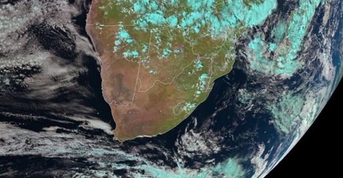
There was better than expected rainfall in the second week of March. The very dry central parts of the country and large parts of the Western Cape had more than 50mm of rain with some localised flooding in areas with heavier rainfall. The heavy rains in the southern parts were caused by a cut-off low that developed, drawing moisture from the tropics over the western parts of the country.
Rain over the central to western summer crop areas in March was just in time, or about a week too late to prevent drought damage. Severe damage, especially to the maize crop in early reproductive stages, had already occurred in some parts before the rain fell. The hot, dry conditions currently prevailing are set to cause drought damage to summer crops since the soil water recharge was insufficient to meet the high water demand of crops now in peak water use stages.
Drought conditions intensified over the extreme north-western and western to south-western parts of the country. The situation will become increasingly serious with the approach of winter as farmers are left with very little, or no, food for their animals.
Surface water for large irrigation schemes and storage dams in the summer rainfall area is now sufficient for the winter. However, a problem may start to develop in the 2019/20 season with storage dams that have not been recharged as expected and the rainy season nearing its end. Smaller dams and farm dams are already showing low levels, even for winter production.
The water situation in the Western Cape is better than it was last year at the same time, with the rainy season on hand. If there is not enough rain in the next three to six months, the situation could once again escalate to drought conditions with a shortage of water.
El Nino and the Indian Ocean
The unpredictability of El Nino continues with lower sea surface temperatures since the beginning of March. Although sea surface temperatures dropped by about 0.3˚C in all the Nino-areas, except Nino 1 and Nino 2, the areas are still solidly in a weak El Nino state. It is too early to predict with any certainty what will happen during winter, and in the summer of 2019/20, because of the volatile status of temperatures in the Nino areas during winter and early spring.
The southern oscillation index (SOI), the measure of interaction between sea surface temperatures and climate systems, has remained negative since about the beginning of February with a 30-day average value on 19 March of -12.53 (-30 = very strong El Nino and +30 = very strong La Nina).
Warming of the Indian Ocean to the east and south of Madagascar has taken place in the latter half of February. The Indian Ocean dipole index (IOD) is now in the neutral phase, but it is expected to change to neutral/positive in the months to come. A positive phase of the IOD is a negative signal for rainfall for Southern Africa, and vice versa for the negative phase.
Expected rainfall and temperature conditions
The rainfall season is rapidly coming to an end. Short-term forecasts are however still indicating that there is some rain possible in the last week of March and in the second week of April, but heavy falls are not expected, especially over the central to western parts of the country.
Expected rainfall conditions are poor over most of the western parts of the country including the western parts of the Northwest Province, western to southern parts of the Northern Cape and western parts of the Eastern Cape.
Frost
The frost risk remains high for late-planted summer crops but short- to medium-term forecasts show temperatures of below 5˚C will occur only towards the latter part of April. Frost in the last two weeks of April could still cause some damage to maize and sunflower crops.
Winter rainfall areas
Very little rain is expected in the coming weeks over the south-west Cape, but light falls are possible over the southern Cape, the eastern coastal areas and the adjacent interior.
Namibia
It likely there will be very little rain in Namibia for the rest of the summer and autumn. Light falls only are possible in some areas, in the last week of March.