In his latest newsletter on climate and agricultural conditions, Johan van den Berg of Santam Agriculture says the far western and south-western parts of the country are still suffering severe drought conditions.
©otto du plessis via
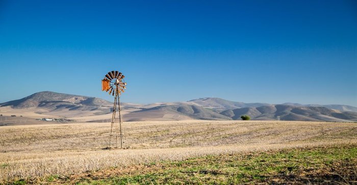
123RFVan den Berg explains that, although surface water conditions in most areas are better than they were last year, sub-surface water from which boreholes pump is becoming critical. Water replenishment took place as far back as the 2010/11 season with below average rainfall in many areas since then and very little water penetrating deeper layers of the soil.
In his recap of the season to date, he writes:
"Rain occurred over the eastern summer crop production areas towards the end of the planting window for maize and soya beans in November 2018. Rain over the central to western summer crop areas only started just before the end of 2018.
This was already past the planting window for maize and the crop was in general planted about one to two weeks after the close of the "acceptable" planting window. This poses a high risk for early frost damage. If frost occurs before the end of April, damage to the crop will be inevitable. It is estimated that about 70% to 80% of the maize planted towards the west of the N1, has been planted after the close of the acceptable planting window and [this] is probably close to 50% of the total maize crop to be planted.
There is still time until about the last week of January to plant sunflower seed in the central to western production areas. Another feature of the season is the occurrence of stormy weather with strong winds and large hailstones associated with heavy falls of rain over localised areas. Examples of this are the storms that hit Sun City, Bela-Bela, Middelburg, Reitz, Ventersdorp and areas to the west of Johannesburg.
There has been light rainfall over the Western Cape, especially towards the south coast. This is not typical for this time of the year, indicating the absence of ‘normal’ weather patterns this season.
El Nino and the Indian Ocean
The 2018/19 season will probably be remembered as one of the most difficult seasons in terms of rainfall forecasts. This is partly due to volatile sea surface temperatures in the Indian and the Pacific Oceans. El Nino conditions in terms of sea surface temperatures exceeded limits only in October 2018 after earlier forecasts of a much earlier development. At the end of December 2018, there was still no coupling of El Nino and weather systems with the Southern Oscillation Index still on the La Nina side of neutral. Looking at the sea surface temperatures in the Pacific, there is a large pool of cooler than normal sea surface temperatures just to the south of the Nino-areas. It is possible that this pool may disturb the normal effect of El Nino or neutralise its effect.
The latest indications are that El Nino has probably reached its peak and may start to decay but we know from experience that there are phases of development that can strengthen again so there is still a high level of uncertainty.
The Indian Ocean also showed huge spatial variation with cooler than normal sea surface temperatures on the west coast of Australia but warmer water in the central to western Indian Ocean, reaching the positive phase of the Indian Ocean Dipole (IOD) Index. A positive IOD is negative for rainfall over Southern Africa. The IOD has weakened since November and is now in a neutral phase.
Expected rainfall and temperature conditions
Summer rainfall areas
Short term forecasts show improved probabilities for rainfall from about 15 January to 23 January over most of the country, except for the western and southwestern parts of the northern Cape and western parts of the Eastern Cape. There is a very high level of uncertainty about expected rainfall for the rest of the summer season.
There are two probable scenarios in terms of the current season looking forward.
Western parts of the country (roughly to the west of the N1), excluding the far western half of the northern Cape and western parts of the Eastern Cape:
• Average rainfall for the rest of January and first part of February with dry conditions in the last part of the season with the effect of El Nino that comes into play (70% probability).
• El Nino reaction not typical or can weaken rapidly. Good rainfall for rest of the season. (30% probability). Compare 1987/88.
Eastern parts (east of N1):
• Average rainfall for the rest of the season until the end of March. El Nino effect not severe to the east (70% probability).
• Below average rainfall for February and March (30% probability).
• Analysing frost dates for different areas, there is about a 40% probability of light frost in the Northwest Free State (Bothaville) before 10 April and 20% to 30% probability for moderate to severe frost between 20 April and 30 April. The risk is much lower towards the north-western production areas (Lichtenburg) where there is only about a 10% probability for moderate to severe frost before 30 April. Frost occurred as early as 20 March in 2007 but as late as the end of May in 2016.
Winter rainfall areas
Some light falls of rain are still possible with cold fronts visiting the southern tip of the country. Rain is possible in the coming weeks, especially towards the south coast.
Namibia:
The same scenarios apply for Namibia as for the western parts of South Africa. The southern parts of Namibia may be added to the western parts of the northern Cape where prospects for rain in the coming months are poor.
Things looking difficult for the western part of the country
Rainfall and agricultural conditions improved with some rain in the last week of December and first part of January, but rainfall was very patchy. There was very little or no rain in the extreme western parts.
There is a high risk for unfavourable rainfall conditions in the western half of the country and a high level of concern about livestock grazing conditions in these parts. Frost poses a real risk for maize crops planted very late. El Nino development and its effect on climate remain uncertain. Some indications are that El Nino has already reached a peak.