Related
Top stories


Energy & MiningGlencore's Astron Energy gears up with new tanker amidst Sars dispute
Wendell Roelf 11 hours

More news


Logistics & Transport
Uganda plans new rail link to Tanzania for mineral export boost


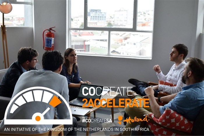
One attention grabbing match-up is between South African startup and aerial data analytics specialist Aerobotics and RanMarine, a Dutch environmental technology enterprise which builds drones that remove waste from the water and support the natural resilience of our oceans. We catch up with Aerobotics to find out more about what they do and their participation in the #cocreate2Accelerate programme.
We are building an aerial data analytics platform to optimise crop performance for farmers around the world. We are based out of Cape Town, and largely a data analytics/data science company focusing on automatically extracting meaningful insights from imagery - helping farmers with their day-to-day operation.
We have developed a data analytics platform that provides meaningful plant level data to farmers to optimise their yields and reduce their costs. The solution allows farmers to manage their crops on a plant by plant basis, tracks improvement over time from farming initiatives and automates variable rate applications for inputs such as fertiliser.
A farmer or service provider flies one of our automated drones, with a multispectral camera whereafter the imagery is uploaded through our web based platform. The data is automatically processed through our cloud-based processing pipeline. This includes stitching the individual images into maps of the scanned area and then running analytics turning the imagery into data. For trees, for example, our machine learning algorithms automatically find individual trees and calculate a range of metrics on a per-tree basis. This allows us to generate actionable analytics, on a tree-by-tree basis as well as build predictive algorithms through the rich data set. We also present the data through our web application Aeroview which allows farmers to simply manage their farm.
Our primary clients are farmers and farm consultants, but we are aware that the data we are collecting from farms is also very useful for other parties in the value chain, such as insurers, banks, fertilising companies, etc. We have been working on building out a crop insurance solution with insurance providers over the last few months.
Farmers: Our product helps optimise the way you farm, helping with early problem detection, improved resource allocation, and increased yield.
Farming consultants: We offer farming consultants a tool which adds value and accuracy to their existing service. This will help them bring on new clients as well as scale and service existing clients better - through less time scouting on the ground and more targeted analyses.
Insurance providers: More quantifiable crop/farm analyses through accurate comparisons of the actual crop, higher penetration through a product that adds value to farmers themselves too, better understanding of risk-pool, lower fraud rate (through quantifiable satellite data).
We aim to create change through making this data accessible to farmers around the world. Along with allowing farmers to make more data-driven decisions, becoming more efficient with their inputs and improving their outputs - this technology could help farmers gain access to added value services such as finance and insurance, which before might not have been available/affordable.

During #cocreate2Accelerate we looked into a specific problem regarding river water management. Along with RanMarine, who have built a water-based drone called the WasteShark which clears water waste, we have proposed a solution to combine aerial and water based sensing, to efficiently improve our water sources. We have outlined a solution which uses the aerial drone data to map out an area of interest, generating a map/plan of where to focus efforts on the water. After the WasteShark has run through the area, we would again scan aerially to generate an accurate comparison of before and after. This would compare both matter within the water and surrounding vegetation. We hope to pilot this project in Cape Town, before looking to run a few projects in the Netherlands.
Apart from this specific idea, we expect to collaborate on other fronts with RanMarine (and the Netherlands), using our respective networks to help each other expand into new territories.
On the product side, I see us getting more detailed and predictive with our analytics as the technology and industry advances. This would mean moving towards things like physical fruit counts (using higher resolution imagery) and disease detection (using hyperspectral imagery).
Commercially, we hope to gain a significant presence in Africa, starting in sub-Saharan Africa. Working with corporate partners or other agri-stakeholders, we would like to lower the cost of the technology for the farmer - allowing us to enter these markets.
