Top stories


AutomotiveHilux Custom Builds offers purpose-built solutions for your business
Toyota South Africa Motors 16 Feb 2026
More news


Marketing & Media
Ads are coming to AI. Does that really have to be such a bad thing?


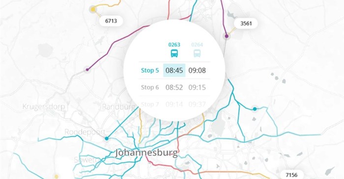
For the first time, access to reliable data from South Africa’s most-used public transport mode is now possible for every major metropolitan region in the country, as well as Gaborone, Botswana.
Informally run minibus taxis serve around 70% of the Gauteng region’s population. However, little documentation on these services exists. WhereIsMyTransport’s 40 data collectors spent roughly six weeks tracking the networks, collecting 2,813 unique routes, covering 44,352 kilometres, and finding an average journey cost of R13.13 (0.73 GBP, 0.97 USD).
WhereIsMyTransport CEO Devin de Vries comments: “This data collection milestone is significant not just because of the task of digitalising informally run public transport information in an urban mega-region, but because it means that unparalleled public transport data is now available from all of South Africa’s major cities.”
This achievement arrives during South Africa’s Transport Month - an initiative which raises awareness of the importance of accessible transport. Improving accessibility is just one of the ways to harness the expansive data reach of WhereIsMyTransport. Our comprehensive data makes us a reliable partner for anyone looking to add value through information from South Africa's cities.”
The company uses technologies developed in-house which enable data to be reliably collected and verified. This includes a mobile application for capturing route data and information such as on and off-peak timing, common stopping points, fares and frequency. Data collection teams are made up of those who live and work locally, ensuring extensive public transport knowledge and valuable qualitative inputs.
Access to unique public transport data can provide the basis for insight and analysis. Contextual information, such as the public transport stops and route locations, can add value to digital services like maps or on-demand transport. Journey planning services, provided through WhereIsMyTransport’s powerful platform, offer businesses new revenues and/or ridership by providing passengers with valuable information.
Data access from WhereIsMyTransport caters for the most commonly used geo-spatial formats, KML and Shape Files, and General Transit Feed Specification (GTFS). Additionally, developers can access data through the WhereIsMyTransport platform. Developer access to data from Gauteng is available now on request. Platform users can email moc.tropsnartymsierehw@olleh to request access.